Fujairah is one of the seven emirates of the United Arab Emirates and the only one located entirely on the country's eastern side, facing the Gulf of Oman rather than the Arabian Gulf.
That geography gives Fujairah a noticeably different character from the UAE's western coastal emirates.
The Hajar Mountains rise across much of the landscape, separating the eastern coast from the interior. Between the mountains and sea are wadis, agricultural areas, towns, beaches and the main urban centre of Fujairah City.
The emirate's history is equally varied.
Archaeological evidence points to human settlement going back thousands of years. Forts, old villages and irrigation systems show how communities adapted to mountain terrain and limited water, while fishing and agriculture supported local life for generations.
Modern Fujairah has also developed into an important maritime and logistics centre because of its position on the Gulf of Oman.
Today, the emirate combines mountain landscapes, historic settlements, coastal communities and modern industry in a way that makes it distinct within the UAE.
| Fact | Details |
|---|---|
| Emirate | Fujairah |
| Country | United Arab Emirates |
| Capital | Fujairah City |
| Area | Approximately 1,580 sq km |
| Coast | Gulf of Oman |
| Coastline | Approximately 70 km |
| Population | Around 314,829 in mid-2024 |
| Official language | Arabic |
| Currency | UAE Dirham (AED) |
| Time zone | UTC +4 |
| Climate | Hot desert climate with strong mountain influence |
| Known for | Hajar Mountains, Gulf of Oman coast, forts, wadis and maritime trade |
Fujairah is both an emirate and the name of its capital city.
The Emirate of Fujairah is one of the seven emirates that form the UAE.
Fujairah City is its capital and principal urban centre.
The difference matters because the emirate extends well beyond the city.
Mountain settlements, coastal towns, wadis, agricultural areas and historic sites are spread across the wider territory.
For this reason, a general guide to Fujairah should explain the emirate as a whole rather than treating Fujairah City as if it represented the entire region.
Fujairah lies on the eastern side of the United Arab Emirates.
Its coastline faces the Gulf of Oman, giving the emirate direct access to waters outside the Strait of Hormuz.
This position is strategically important for shipping and trade.
The Hajar Mountains run through much of the emirate, creating a rugged landscape between the interior and the coast.
The geography is also unusual because parts of Fujairah's territory are separated by areas belonging to other emirates.
For example, Kalba, which belongs to Sharjah, lies along the eastern coast and creates a break between Fujairah-controlled territories.
This makes Fujairah's map more complicated than a single continuous block of land.
Fujairah City is the capital and largest urban centre of the emirate.
It contains government offices, residential neighbourhoods, commercial districts, the main port area and much of the emirate's modern infrastructure.
The city sits between the Hajar Mountains and the Gulf of Oman.
This setting means the urban landscape is closely connected with both mountain terrain and the sea.
Modern roads, businesses and residential development have expanded rapidly, but the city still contains historic sites that connect it with earlier periods of settlement.
Fujairah Fort and nearby heritage areas provide some of the clearest links between the modern capital and the emirate's political history.
The Hajar Mountains are one of Fujairah's defining geographical features.
They separate the eastern coast from much of the UAE's interior and create a landscape of steep ridges, rocky valleys and wadis.
These mountains influenced where people lived.
Communities often developed where water could collect in valleys or underground systems.
Mountain runoff could support agriculture in areas where soil and water conditions were suitable.
The mountains also affected travel.
Before modern highways, routes through wadis and mountain passes connected eastern settlements with other parts of the region.
Even today, Fujairah's terrain gives the emirate a very different appearance from the flatter landscapes associated with much of the UAE.
Wadis are dry or seasonal river valleys that channel water after rainfall.
In Fujairah, they have played an important role in both geography and settlement.
Rain falling over the Hajar Mountains can move through valleys and collect in lower areas.
Historically, communities learned to make use of this water for agriculture and everyday life.
Some settlements developed near groundwater sources or areas where runoff could be captured.
This relationship between mountains and water helps explain why farming became more important in Fujairah than many people might expect from a hot, arid climate.
Water management remains essential today because rainfall is limited and irregular.
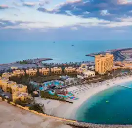
Fujairah's eastern coastline is one of the emirate's strongest geographical differences from the rest of the UAE.
Instead of facing the Arabian Gulf, Fujairah looks towards the Gulf of Oman.
This gives the emirate direct access to major shipping routes outside the Strait of Hormuz.
The coast includes beaches, fishing areas, rocky sections and marine habitats.
The waters off Fujairah are also deeper than many shallow coastal areas on the western side of the UAE.
That has helped support modern maritime activity.
Fishing remains part of local life, while the coast also supports tourism, port operations and commercial shipping.
Human settlement in Fujairah stretches back thousands of years.
Archaeological evidence from different parts of the emirate suggests communities were living in the region by around 3000 BC.
Mountain valleys, water sources and access to the coast all contributed to the development of settlement.
Archaeologists have found tombs, pottery, tools, structures and irrigation features from different periods.
These discoveries show that Fujairah was not isolated.
Communities here were connected with wider cultural and trading networks across southeastern Arabia and the Gulf.
The archaeological record also reveals how people adapted to difficult environmental conditions over long periods of time.
Bithnah is one of the most important historic areas in inland Fujairah.
Its location along a route through the mountains made it strategically significant.
The area contains archaeological remains and historic fortifications that help explain the importance of inland travel routes.
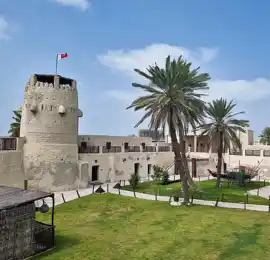
Bithnah Fort is one of the emirate's best-known heritage structures.
Its position allowed communities to monitor and protect movement through the surrounding landscape.
The wider archaeological area also contains evidence of much older settlement.
This shows that Bithnah was significant long before the fort itself was constructed.
Masafi is another important inland area associated with settlement, agriculture and water.
Archaeological investigations in the area have revealed evidence of early irrigation systems.
Iron Age aflaj, or traditional water channels, demonstrate how communities developed methods for moving groundwater towards farms and settlements.
These systems were essential in a region where reliable rainfall could not be depended upon.
Masafi's history therefore provides a useful example of how water technology allowed communities to survive and farm in a mountain environment.
The area remains associated with agriculture and water today.
The modern political history of Fujairah is closely connected with the Al Sharqi ruling family.
The Al Sharqi emerged from the Sharqiyin tribal group, which had long-standing connections with eastern settlements.
Fujairah gradually developed as a distinct political entity under Al Sharqi leadership.
The history of the emirate reflects the strategic importance of controlling routes through the Hajar Mountains and settlements along the eastern coast.
This political development eventually led to Fujairah being recognised as one of the Trucial States.
The Al Sharqi family continues to rule the emirate today.
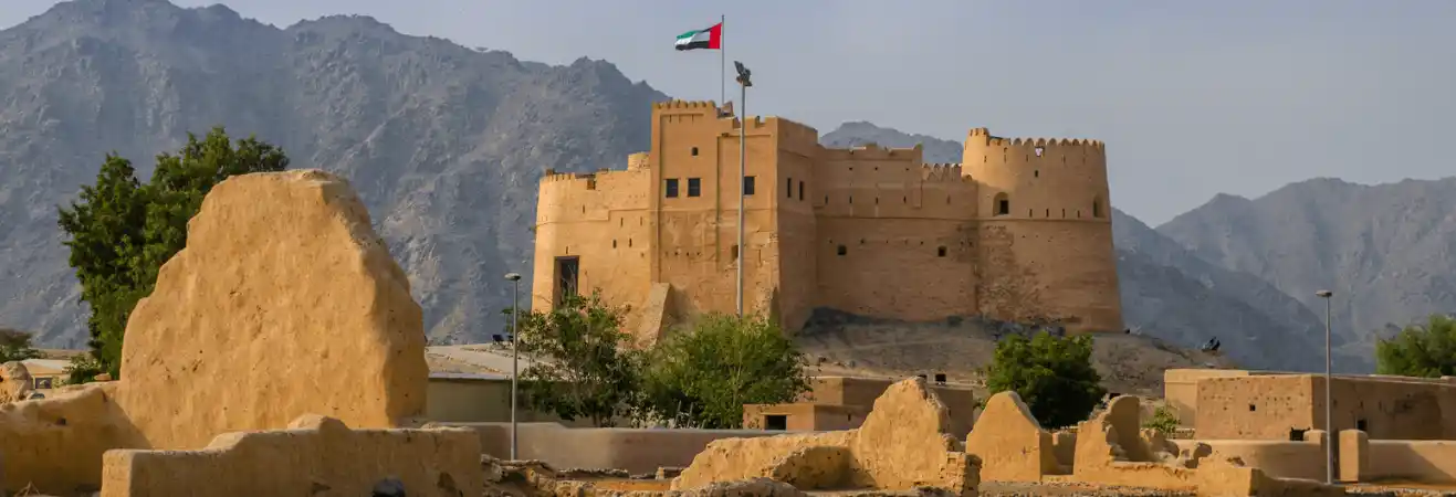
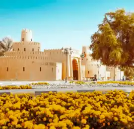
Fujairah Fort is one of the most recognisable heritage buildings in the emirate.
Built using traditional materials, the fort served defensive and administrative purposes.
Its location near older settlement areas reflects the need to protect communities and important routes.
The fort has undergone restoration and now forms part of the emirate's heritage landscape.
Rather than functioning only as a monument, it helps explain how government, defence and settlement were organised before modern urban development.
The surrounding heritage area adds further context through traditional buildings and cultural displays.
Al Bidya Mosque is one of Fujairah's most distinctive historic religious buildings.
The small mosque is known for its traditional construction and unusual roof design.
Its age has been discussed in different sources, so it is safer to describe it as one of the UAE's oldest surviving mosques rather than attaching an exact date without qualification.
The mosque sits near other archaeological remains, showing that the area had long-standing settlement importance.
Its continued use also makes it more than an archaeological structure.
It remains part of a living religious landscape.
Fujairah was one of the six emirates that formed the United Arab Emirates on 2 December 1971.
It joined Abu Dhabi, Dubai, Sharjah, Ajman and Umm Al Quwain in establishing the federation.
Ras Al Khaimah joined the UAE the following year.
Since 1971, Fujairah has maintained its own local government and ruling family while participating in the federal system.
The emirate's geographical position on the eastern coast also gives it strategic importance within the wider UAE.
Fishing has supported Fujairah's coastal communities for generations.
The Gulf of Oman provided access to fish and other marine resources.
Boats were essential for food, trade and movement between settlements.
Fishing remains visible in the emirate today.
Modern ports and commercial shipping have changed the scale of maritime activity, but traditional fishing continues alongside larger industries.
This continuity connects modern Fujairah with the communities that depended on the sea long before industrial development.
Agriculture developed where mountain water and suitable soil allowed farming.
Wadis, groundwater and seasonal runoff created opportunities for cultivation in selected areas.
Date palms were important, but farmers also grew fruit and vegetables.
Areas such as Masafi became known for farms and orchards.
Modern agriculture uses pumps, irrigation technology and improved water management, but the environmental challenge remains the same.
Fujairah's agricultural history is closely linked with its mountain geography.
Without access to water from the Hajar system, farming would have been far more difficult.
The Port of Fujairah is one of the emirate's most important modern economic assets.
Its location on the Gulf of Oman provides direct access to major international shipping routes without requiring vessels to enter the Arabian Gulf.
This makes the port strategically important for maritime trade.
Shipping, bunkering, oil storage and logistics have developed around the port.
The emirate's location has therefore transformed from a geographical challenge into an economic advantage.
The same coast that historically supported fishing now plays a major role in global maritime activity.
Fujairah's economy has diversified considerably.
Traditional activities such as fishing and agriculture remain important parts of its identity, but modern growth is spread across other sectors.
Shipping, port services, logistics, oil storage, construction materials, mining, stone crushing, trade and tourism all contribute to economic activity.
The Fujairah Free Zone also supports companies operating in different industries.
In 2024, the emirate's GDP was reported at approximately AED 29.13 billion.
This economic mix reflects the emirate's geography.
Mountains support quarrying and construction-material industries, while the Gulf of Oman coast supports maritime trade and logistics.
Fujairah contains several important natural environments.
Among the best known is Wadi Wurayah, a protected mountain area with valleys, freshwater habitats and wildlife.
The landscape demonstrates that Fujairah's mountain ecosystem is more complex than bare rock.
Seasonal and permanent water sources can support vegetation and animal life that would struggle in more exposed desert conditions.
The emirate also contains coastal ecosystems, beaches, wadis and agricultural valleys.
This natural variety gives Fujairah a very different environmental identity from the UAE's largest cities.
Fujairah is part of a country dominated by arid landscapes, but its geography should not be oversimplified.
Mountains and wadis are the most visible features across much of the emirate.
There are also plains, agricultural areas, coastal environments and some desert terrain.
It would therefore be inaccurate to say Fujairah has no desert at all.
At the same time, the emirate is not defined by vast open dune fields in the same way as some western areas of the UAE.
Its landscape is primarily shaped by the Hajar Mountains and the Gulf of Oman coast.
Fujairah's culture reflects its mountain and maritime environment.
Coastal communities developed traditions around fishing and seafaring.
Inland communities depended more heavily on agriculture, livestock and water management.
Forts and watchtowers reflect the need to protect settlements and routes.
Traditional architecture used local materials and building techniques suited to hot conditions.
Hospitality also remains an important part of Emirati culture.
Arabic coffee and dates are traditionally used to welcome guests, while family and community relationships continue to play a central social role.
Modern Fujairah is multicultural, but these older traditions remain visible through heritage sites, farms, fishing communities and cultural events.
Fujairah has a hot desert climate, but its weather differs somewhat from the UAE's western coast.
The Hajar Mountains influence rainfall and local conditions.
Summers are extremely hot, and coastal humidity can be high.
Winters are milder and generally more comfortable for outdoor exploration.
Mountain areas may experience cooler conditions than the coast.
Rainfall remains limited, but Fujairah can receive more mountain-related rain than some flatter parts of the UAE.
When heavy rain occurs, wadis can fill quickly.
Visitors should take weather conditions seriously when entering mountain valleys during unstable weather.
Fujairah is connected with Dubai, Sharjah and the other emirates by major roads through the Hajar Mountains.
Driving is one of the easiest ways to reach and explore the emirate.
Travel times vary depending on the starting point and route.
Within Fujairah City, taxis and private vehicles are commonly used.
A car becomes especially useful when exploring locations outside the capital.
Historic forts, mountain settlements, beaches and wadis are spread across a wide area.
Visitors should therefore allow realistic travel time between different parts of the emirate.
Fujairah makes more sense when its geography and history are viewed together.
The Hajar Mountains explain the wadis, water systems and agricultural settlements.
The coast explains fishing, maritime trade and the modern importance of the port.
Archaeological sites reveal thousands of years of human settlement.
Forts and old villages preserve evidence of political and community life before modern development.
Fujairah City represents the modern administrative centre, while places such as Bithnah, Masafi and Al Bidya show different parts of the emirate's story.
Visitors who explore beyond the capital can therefore see a much broader picture of Fujairah.
Fujairah is sometimes described mainly through beaches and mountain scenery.
Both are important, but they explain only part of the emirate.
Its archaeological sites show how communities adapted to the eastern mountains thousands of years ago.
Aflaj systems demonstrate sophisticated water management.
Fishing connects generations of residents with the Gulf of Oman.
Forts and settlements preserve the political history of the Al Sharqi ruling family.
And the modern port shows how Fujairah's eastern location became one of its greatest economic advantages.
Together, mountains, wadis, coast, archaeology, agriculture, maritime heritage and modern logistics give Fujairah one of the most distinctive identities in the United Arab Emirates.